
Page 12 - 2024 - 51.1
P. 12
The Conundrum... continued from previous page
“formerly run by state authorities of California in 1863 and at Crystal
Peak the link is moved 61 cha. 15 lks [4,035.9’] E of said old line…[which]
with very few exceptions, runs over a most miserable and worthless tract of
country, and any change made from the line run in 1863 will make but a very
little difference to either the State of California or Nevada, so far as taxable
property is concerned” (1872 Letter, 14).
GLO Commissioner Drummond accepted Von Schmidt’s survey of the
northeastern boundary line of California, reversing his 1868 acceptance
of Daniel Major’s line, even though he still had concerns about the lower
portion of the state boundary.
As Von Schmidt’s monument has long been accepted as the
actual northeastern corner of California, my efforts to find his rock mound
were fruitful. There was never a question about whether I would find this
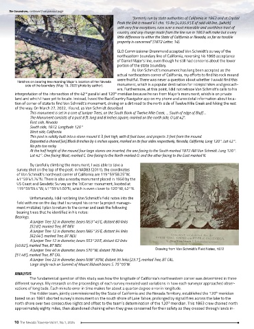
Notches on bearing tree marking Major’s location of the Nevada
side of the boundary (May 15, 2022 photo by author). monument, which is a popular destination for intrepid hikes and geocach-
ers. Furthermore, at this point, I did not retrace Von Schmidt’s calls to his
interpretation of the intersection of the 42 parallel and 120 meridian because he ran from Major’s monument, which is on private
th
nd
land and which I have yet to locate. Instead, I used the BackCountry Navigator app on my phone and anecdotal information about loca-
tion of corner of state to find Von Schmidt’s monument, driving on a dirt road to the north side of Twelve Mile Creek and hiking the rest
of the way. On March 27, 2022, I found, as Von Schmidt described
This monument is set in a core of Juniper Trees, on the South Bank of Twelve Mile Creek, … South of edge of Bluff…
The Monument consists of a post 8 ft. long and 8 inches square, marked on the north side, O Lat 42°.
East side, Nevada
South side, 1872. Longitude 120°
West side, California.
This post is solidly built into a stone mound 6 ½ feet high, with 8 foot base, and projects 3 feet from the mound.
Deposited a chaned [sic] Block 8 inches by 4 inches square, marked on its four sides respectively, Nevada, California, Long 120°. Lat 42°.
No pits too rocky.
At the half height of the mound four large stones are inserted, the one facing to the South marked 1872 AW Von Schmidt. Long 120°.
Lat 42°. One facing West, marked C. One facing to the North marked O. and the other facing to the East marked N.
By carefully climbing the monument, I was able to take a
survey shot on the top of the post. In NAD83 (2011), the coordinates
of Von Schmidt’s northeast corner of California are 119°59’58.25”W,
41°59’41.74”N. There is also a nearby monument placed in 1950 by the
US Coast and Geodetic Survey as the TriCorner monument, located at
119°59’59.4”W, 41°59’41.00”N, which is even closer to 120°W, 42°N.
Unfortunately, I did not bring Von Schmidt’s field notes into the
field with me on the day that I surveyed his corner (a project manage-
ment mistake). I plan to return to the corner and seek the following
bearing trees that he identified in his notes:
Bearings.
A Juniper Tree 32 in diameter, bears N53°45’E, distant 80 links
[52.8’], marked Tree, BT NEV.
A Juniper Tree 12 in diameter, bears N85°35’E, distant 94 links
[62.04’], marked Tree, BT NEV.
A Juniper Tree 12 in diameter, bears S53°20’E, distant 62 links
[40.92’], marked Tree, BT NEV.
A Juniper Tree 40 in diameter, bears S70°W, distant 78 links Drawing from Von Schmidt’s Field Notes, 1872
[51.48’], marked Tree, BT CAL.
A Juniper Tree 22 in diameter, bears N38°30’W, distant 35 links [23.1’], marked Tree, BT CAL.
Large single rock on Summit of Mount Bidwell bears S. 75°05’W.
ANALYSIS
The fundamental question of this study was how the longitude of California’s northeastern corner was determined in three
different surveys. My research on the proceedings of each survey revealed vast variations in how each surveyor approached obser-
vations of longitude. Each minute error in time makes for about a quarter degree error in longitude.
The Kidder team, jointly commissioned by the State of California and the Nevada Territory, established the 120 meridian
th
based on an 1861 aborted survey’s monument on the south shore of Lake Tahoe, prolonged by signal fires across the lake to the
north shore over two consecutive nights and offset to the team’s determination of the 120 meridian. This 1863 crew chained north
th
approximately eighty miles, then abandoned chaining when they grew concerned for their safety as they crossed through lands in-
10 The Nevada Traverse Vol.51, No.1, 2024