
Page 14 - 2023 - 50.4
P. 14
The Conundrum... continued from previous page
Major’s 1868 monument, however, lies just north of the creek and close to an access road, but on private land. By georeferencing an
1879 survey plat in ArcGIS Pro and also using the Ruler tool in Google Earth to retrace the same survey’s calls for the monument, I was
able to identify exactly where I should search for this monument. Using
the Lake County, Oregon and Modoc County, California Assessor’s Offices
websites, I was able to identify the parcel numbers of the property. One
landowner owns Twelve Mile Ranch, which straddles the state line along
the creek. I was able to obtain the landowner’s name and postal address,
which was the only available way to contact him. I wrote the landowner
a letter explaining my project and requesting access to his property. He
called several weeks later to discuss the project and agreed that I could
access his land.
Another key method that helped make sense of the disparate surveys of
this region was to create an Excel spreadsheet with details about each sur-
vey, including the names of the surveyors and commissioning bodies and
officers, relevant field note pages and calls, and instruments mentioned.
I build this spreadsheet as I read and collected data, which informed my
later efforts to see connections among the details; making these links was
critical to being able to tell this story.
All readings were post-processed in the LS by Data Processing Service
(DPOS), which is similar to the National Geodetic Survey’s Online Position-
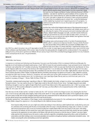
Base station, looking south
ing User Service (NGS OPUS); DPOS also processes GLONASS data from
stations that record data from those satellites. I exported the survey data
into CSV files, which I imported into an XY data table in ArcGIS Pro, in order to create layouts and eventually a story map to tell the story
of the confusion over the location of this corner. I also imported the same points into Google Earth to produce slides for the purpose of
telling the story of this land. I geoferenced William Minto’s survey map in ArcGIS Pro and attached geotagged photos from my fieldwork
to the surveyed points for use in my presentation.
RESULTS
1863 Kidder-Ives Survey
In response to confusion and bickering over the previous few years over the location of the line between California and Nevada, the
legislatures of both bodies authorized a joint survey in April 1863 to locate the permanent boundary; it was well past time to resolve the
confusion over where the 120 meridian actually lay. The established State of California was ever fearful that the new Nevada Territory
th
would “deprive California of a strip of her territory 300 miles long by from 15 to 50 miles wide” (Reed 1998, 53). Apart from the value
of the population for votes and property taxes, the contended area was also rich in silver ore and other highly desired natural resources.
Orion Clemens (brother of Mark Twain), the Nevada Territory Secretary and acting in the absence of Governor Nye, called for a survey,
seconded by California’s Surveyor-General J.F. Houghton, who was authorized by the California Assembly to establish lines on “all that
part of the said boundary lying between the first named point, near Lake Bigler [Lake Tahoe], and due north from said point to the
southern boundary of Oregon…” (Hulse 1980, 99; Reed 1998, 54).
The jointly-commissioned survey team reporting on May 22, 1863 included John Kidder, at least nine other crew members, and twenty-
five pack animals. The crew used as its point of beginning a point on the north shore of Lake Tahoe. This beginning point was estab-
lished by prolongation over two nights of signal fires from a point three miles south on the opposite shore, set in 1861 by surveyor John
Ives as part of an 1855 aborted attempt to locate the 120 meridian, and then offset to the measured location of the 120th (Hulse
th
1980, 95-101; Uzes 1977, 78).
Over the next month, Kidder ran the line that he held to be the 120 meridian north to the Oregon border, only chaining the line from
th
Lake Tahoe to Honey Lake Valley about eighty miles to the north. North of Honey Lake Valley (the location of the Sagebrush War earlier
the same year), Kidder and his team stopped chaining and took daily measurements for latitude and calls to prominent objects, out of
concern about attracting unwanted attention from the local Paiute Indians.
The finally reached their interpretation of the Oregon border and established a monument for the northeast corner of California on July
7, 1863. Kidder relayed the experience in the Annual Report to the California Surveyor-General:
From Surprise Valley, the line runs over a high rocky divide, descending to Crane Lake [now called Cowhead Lake, mostly dried up and used
for cultivation], and connecting with the forty-second parallel, where the same is naturally defined by a large creek, or stream, in a cañon
with almost perpendicular sides of rock one hundred and fifty feet in depth [Twelve Mile Creek and Canyon]. At this point, while taking
observations for latitude, July the seventh, (our camp, with a large portion of our men, being some three miles distant,) we were suddenly
surprised, by the appearance of some Indians of the Modoc tribe, who did not discover us until the shout of “Indians” was given. Appar-
ently surprised, they retreated across the ravine or cañon, and built a signal fire, immediately answered by others, while we finished our
observations; and after building a stone monument, (probably not as perfect as though we had been undisturbed,) retreated to camp – the
Indians recrossing the cañon and building several more signal fires.
12 The Nevada Traverse Vol.50, No.4, 2023