
Page 29 - 2024 - 51.1
P. 29
considering the sensor’s scanning speed is crucial for efficient data 7. Data Processing and Compatibility
acquisition. Aircraft speed along the flight line is another factor. The quality of the collected data is only as good as the processing
Faster scan speed may result in larger point density, but that can capabilities of the software you use. Assess the workflow of data
be negated if the drone flies too fast for the requirements. Balanc- processing and compatibility with software applications com-
ing the scanning pattern and speed is essential to achieve optimal monly used in aerial mapping projects. Also, asses your staff’s
results without compromising data quality. skill level and their ability to use the software successfully. If your
firm’s staff does not have the skill level, you may opt for a more
automated workflow that saves time and effort. However, the
time savings may mean you don’t have the trained expertise to
identify and analyze errors. There are black box one button op-
tions, and there are professional software suites with full manual
control of processing steps. The increase in software and staffing
costs may be the difference in successfully delivering data and
retaining clients. LiDAR processing is not easy, do not believe a
person who tells you that it is.
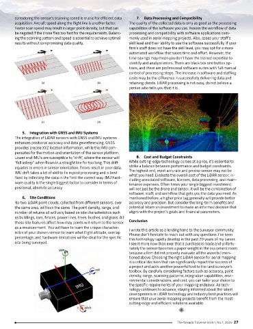
5. Integration with GNSS and IMU Systems
The integration of LiDAR sensors with GNSS and IMU systems
enhances positional accuracy and data georeferencing. GNSS
provides precise XYZ location information, while the IMU com-
pensates for the motion and orientation of the sensor platform.
Lower end IMU’s are susceptible to “drift”, where the sensor will 8. Cost and Budget Constraints
“fall asleep” when flown in a straight line for too long. This drift While cutting-edge technology comes at a price, it’s essential to
equates to errors in sensor orientation. Errors result in poor data. strike a balance between performance and budget constraints.
IMU drift takes a lot of skill to fix in post processing and is best The highest end, most accurate and precise sensor may not be
what you need. Evaluate the overall cost of the LiDAR sensor, in-
fixed by collecting the data in the field the correct way. IMU hard- cluding associated software, licenses, data processing, and main-
ware quality is the single biggest factor to consider in terms of tenance expenses. Often times your single biggest investment
positional, absolute accuracy. will not just be the drone and sensor, it will be the combination of
software, staff, and workflow that gets you the data you need. As
6. Site Conditions mentioned before, a higher price tag generally will provide better
No two LiDAR point clouds, collected from different sensors, over accuracy and precision. But consider the long-term benefits and
the same area, will look the same. The point density, range, and potential return on investment to make an informed decision that
number of returns all will vary based on site characteristics such aligns with the project’s goals and financial parameters.
as buildings, cars, fences, power lines, trees, bushes, and grass. All
these site features affect how may points will return to the sensor Conclusion
as a measurement. You will have to learn the unique character- I wrote this article as a lending hand to the surveyor community.
istics of your chosen sensor to learn what flight altitude, overlap Please don’t hesitate to reach out with any questions. I’ve seen
percentage, and hardware limitations will be ideal for the specific this technology rapidly develop in the past 20 years of my career.
site being surveyed. I see it more now than ever that a purchase is made and unfortu-
nately the sensor becomes a paper weight in the equipment room
because a firm did not properly evaluate all the aspects I men-
tioned above. Choosing the right LiDAR sensor for aerial mapping
is a critical decision that can significantly impact the success of
a project and adds another powerful tool to the land surveyor’s
toolbox. By carefully considering factors such as accuracy, point
density, range, scanning patterns, integration capabilities, envi-
ronmental considerations, and cost, you can tailor your choice to
the specific requirements of your mapping endeavor. As tech-
nology continues to advance, staying informed about the latest
developments in LiDAR technology and industry best practices will
ensure that your aerial mapping projects benefit from the most
cutting-edge and efficient solutions available.
The Nevada Traverse Vol.51, No.1, 2024 27