
Page 9 - NALS Traverse 50_2
P. 9
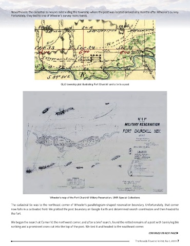
Nevertheless, the cadastral surveyors subdividing the township where the post was located arrived only months after Wheeler’s survey.
        Fortunately, they tied to one of Wheeler’s survey monuments.


                                        GLO township plat illustrating Fort Churchill and a tie to a post


                                 Wheeler’s map of the Fort Churchill Military Reservation, UNR Special Collections

        The cadastral tie was to the northeast corner of Wheeler’s parallelogram-shaped reservation boundary. Unfortunately, that corner
        now falls in a cultivated field. We plotted the post boundary on Google Earth and determined search coordinates and then headed to
        the fort.

        We began the search at Corner IV, the northwest corner, and after a brief search, found the rotted remains of a post with barely legible
        scribing and a prominent cross cut into the top of the post. We tied it and headed to the southeast corner.

                                                                                                 CONTINUED ON NEXT PAGE u

                                                                                        The Nevada Traverse Vol.50, No.2, 2023 7