
Page 8 - NALS Traverse 50_2
P. 8
Retracement...Ft. Churcill.. continued from previous page
Fort Churchill Military Reservation was created in August of 1860, Orders No. 6, issued from the Presidio. It would become the first, larg-
est and arguably the most important post in Nevada. The enlisted barracks were built on the west side of a large parade ground which
measuring roughly five hundred by three hundred feet, with mess halls and kitchens behind them, as seen in the lithograph below. On
the east side of the parade ground were the post headquarters, stores, laundresses’ quarters and hospital. Six double story officer’s resi-
dences lined the north side of the parade ground while the guardhouse, power magazine, bakery, stables and corrals were on the south
side. All the buildings faced inward toward the parade ground.
During the construction of the fort, controversies arose concerning the expenditures for materials, transportation and some contract
labor hired to help complete the fort before winter. Despite the explanation that costs for everything were extremely high in western
Nevada, due to the “Rush to Washoe” and hence the furious mining taking place at Virginia City, the Army was dissatisfied. A Board of
Officers was convened. They met at the fort and produced a report and forwarded it to the Quartermaster General of the Army. There
was a brief stir regarding the costs and numerous buildings that were planned for construction were eliminated. With a looming civil war
on the near horizon, the matter was soon dropped. At the time the post opened there were 337 men and 12 women garrisoned there. 4
After the outbreak of the Civil War, the post kept its status as headquarters and main supply depot for the Nevada Military District. How-
ever, regular Army troops went east to fight in the war and the post was manned first by the 3 Regiment of California Volunteers, and
rd
later by volunteer units raised in Nevada. Southern sympathizers in the area who had been arrested were imprisoned there. It was also
6
5
a Pony Express station and along the telegraph line coming west from the San Francisco. From the fort, troops patrolled the region as far
west as the Sierras, east to Austin and Ruby Valley, and south to Owens Valley in California.
When the Civil War ended the troops began to muster out. By the end of 1866 there was only one company of infantry in the post’s gar-
rison. The headquarters for the military district was moved to Fort Halleck, in Elko County, Nevada. In April of 1868, the designation of
“Fort Churchill”, was briefly changed to “Churchill Barracks”. The new name was quickly ignored. Shortly afterward, Lieutenant Wheeler
arrived to survey the reservation boundary.
Oddly, the Military Reservations that the Corps of Engineers surveyed were often, though not always, in the shape of a parallelogram.
Fort Churchill was no exception.
Based on retracements of his work at other forts in the Southwest, Fort Yuma in particular, Wheeler used somewhat unconventional
methods to develop his surveys as compared with his contemporaries. In fact, Wheeler’s boundary of the Fort Yuma Hay and Wood Re-
serve had to be dealt with in court, in Metropolitan Water District, S. Cal. v. U.S. (1986):
The Court finds that there is a lively dispute as to the boundaries and acreage intended by the United States when it established the (Military)
Reserve. As a guide to the parties, the court notes that it is not as convinced as the parties appear to be that the boundaries actually surveyed by
Lieutenant Wheeler are determinative of the intent of the grantor…the intent of those giving instructions to Wheeler may be more probative of the
intent of the grantor than Wheeler’s intent.
Wheeler often did not run the
boundary lines on the ground.
Rather he sometimes used
triangulation and swing ties
to locate the corners. His
field notes may or may not
reflect his survey methods at
a given fort.
No field notes of Wheeler’s
work at Churchill Barracks
were located. But we did lo-
cate a map of his survey in
the Special Collections Library
at the University of Nevada,
Reno. To our knowledge, no
retracement of Lieutenant
Wheeler’s survey had been
done, so the writers decided
to undertake one.
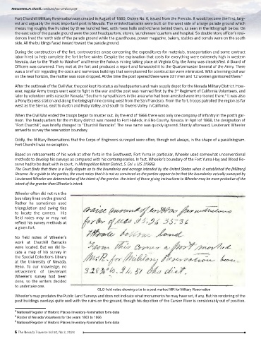
GLO field notes showing a tie to a post marked MR for Military Reservation
Wheeler’s map predates the Public Land Surveys and does not indicate what monuments he may have set, if any. But his rendering of the
post buildings overlays quite well with the ruins on the ground, though his depiction of the Carson River is considerably out of position.
4 National Register of Historic Places Inventory-Nomination form data
5 Roster of Nevada Volunteers for the years 1863 to 1866
6 National Register of Historic Places Inventory-Nomination form data
6 The Nevada Traverse Vol.50, No.2, 2023