
Page 25 - NALS Traverse 50_2
P. 25
“I had never worked like this before, so it was quite cool to watch “We were very pleased with how smoothly the measurement
the lines being adjusted right before my eyes,” said Sellevoll. “And went and that we could do it in real-time,” said Jan Reime, a
because the SX10 locks onto the line, we only had to aim it once project manager with BKK. “An additional bonus for us and our
and follow it on the controller. With a traditional total station, we client was the ability to deliver a written report with the actual
would have had to manually aim the instrument and measure the measurements enclosed.”
cable’s position each time it moved. If it had been windy, it would “We could not have completed the field work or the project report
have been much more difficult to do.” as well and as quickly as we did with traditional total station tech-
A View to New Business nology,” said Sellevel. “The ability to switch between total station
surveying and scanning with one instrument allows us to be so
Although BKK did not require a scan of the power lines, Sell- much more efficient, both in time and costs. As the scanning gives
evoll and Vestbø used the opportunity in the field both to test us the data and detail of an entire project, we can revisit the site
the scanning capabilities of the SX10 and to provide detailed virtually as many times as we need without having to leave the of-
3-D-derived documentation to their client. Setting up near each fice. And with the auto-lock feature of the SX10, we now have the
utility pole, in a position where the cables were about 18 m ability to take on projects that require real-time surveying, opening
directly overhead, they scanned the entire 450-m-long section up a whole range of business development opportunities.”
in two scans, one from the top of the slope and one from the Indeed, based on their debut success in Leikanger, BKK com-
bottom. Collecting 26,600 points per second, each scan took missioned Geomatikk Survey to return to a different section
about 10 minutes to complete, acquiring a 3-D scan of all four of the same power line and perform the same sag-measuring
power lines and two towers in 20 minutes. work. Colleagues all across Norway have also gotten wind of
“The scanner is surprisingly quick and is quite precise,” said that project, and they all seem to be curious about the real-time
Sellevoll. “It can produce a 360-degree scan directly overhead. aspect of surveying.
And it automatically registers the data so you don’t have to This rising interest could lead to more helicopter rides in Sellevoll’s
geo-reference the point cloud during post-processing, which is future. He knows there may be more of the unexpected, but he’s
a huge time savings.” confident he has the right tools to resolve any issues encountered.
Back in the office, the Geomatikk Survey team used Trimble Busi- -This article was originally published in the January 1, 2019 edition
ness Center software to integrate the point-cloud data and survey of Power magazine. Mary Jo Wagner is a Vancouver, British Columbia-
data. They then produced a vector-based report, coupled with based freelance writer with more than 20 years of experience covering
supporting point-cloud screenshots, to verify that the power lines geospatial technology.
were adjusted to BKK specifications. That documentation was
prepared in one day and delivered to BKK the day after. https://www.powermag.com/adjusting-power-line-sag-in-real-time/
ContaCt Us ContaCt Us
Kevin Almeter, PLS - Survey & Mapping Manager Michael Detwler, PLS - Photogrammetrist
Phone: (775) 828-5687 Phone: (775) 828-5688
Email: kalmeter@woodrodgers.com Email: mdetwiler@woodrodgers.com
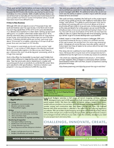
ood Rodgers provides a full range of aerial mapping services, utilizing
Applications W photogrammetry and LiDAR sensors from both manned aircraft and unmanned
Surveying aerial systems (UAS). We have the ability to capture oblique imagery and video,
• Topographic and planimetric maps model surfaces, produce cross sections, compute volumes, surveying vertical structures,
• Elevation and terrain models monitor mining and construction sites, and detect change over time. Our licensed
• Orthorectified imagery Remote UAS pilots ensure data is collected in the safest way and ensuring regulatory
Mining procedures. We use modern digital mapping techniques and workflows to help reduce
• Pit and leach pad volume measurements delivery time and get your project moving through, faster. Our licensed land surveyors
• Disturbance and reclamation monitoring and photogrammetrists will ensure your data meets the accuracy standards you need
• Mine claim base maps for your project each and every time.
• Site documentation for regulator permitting
Monitoring & Inspection
• Geological surface monitoring CHALLENGE. INNOVATE. CREATE.
• Infastructure and facility inspection
• Change detection over time
• Removing personnel from dangerous situations
GIS
• Imagery and elevation layers for databases
• Imagery classification and analysis
WOOD RODGERS ADVANCED TECHNOLOGY PHOTOGRAMMETRY & AERIAL MAPPING
The Nevada Traverse Vol.50, No.2, 2023 23