
Page 30 - NALS Traverse 50_2
P. 30
The GPS On goals for those who need a
better translation, for example
Benchmarks Program in urban areas or mountain-
ous regions. This Transfor-
mation Tool program was
initially set to end December
By: Steven J. Martin, PLS 31 , 2021, at which time the
st
dataset to define the NAVD88
The National Geodetic Survey to NAPGD2022 translation
would have remained fixed.
(NGS) created the GPS on In a desire to have as much
Benchmarks (GPSonBMs) data as possible and in light of
program in 2014 recogniz- delays in the NSRS Moderniza-
ing that well over 90% of the
marks in their database had tion efforts, the deadline was
extended to December 31 ,
st
no GPS observations on them
and many had not had any 2022, and then one last time
to the end of September 2023.
measurements in over 50
years. With only small field In 2021, NGS rolled out Population Priority layer in the web map
crews of its own, NGS called GPS on Bench Marks for the Transformation Tool (arcgis.com).
for a crowd-sourced program These layers take into account where most people live in deter-
for surveyors to submit data mining Priority A marks, and much of the uninhabited areas are
on benchmarks. This data has changed to Priority B. I try to focus on the Priority A marks, with
been critical in developing consideration given to drive time to get to accessible marks.
hybrid geoid models (a geoid
model optimized to work with My involvement with the GPSonBMs program began after I
the NAVD88 vertical datum) retired in early 2021. I had been following the State Plane Coor-
since then. There was a big push leading up to the creation of the dinate System (SPCS) modernization program, but then became
GEOID18 geoid model to get observations on benchmarks at a aware of the importance of the GPSonBMs efforts to the overall
minimum of 30km spacing in-order to improve the accuracy of NSRS Modernization program, so I began to help wherever I
the resultant model. could. At first, I had to borrow equipment, but I was able to spend
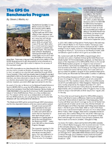
Two GPS observations on a benchmark in the NGS database several weeks in the field, concentrating on San Diego County CA
are required to provide verification. Generally, that means two where I worked for about half my career. Then I was able to ac-
4+ hour occupations on a benchmark submitted through OPUS quire a used GPS system in August of 2022 and branched out to
Share, however if the mark has already been included in a project Clark County and Riverside/San Bernardino Counties in California.
submitted to NGS in the last few decades and the ellipsoid height As of this writing Nevada is at 5% complete on 10km hexagons
matches, one more observation may do. Use of OPUS Projects (it was 4% in August of 2022), California is at 44% completed,
can shorten observation times and even make use of RTK obser- Arizona at 49%. Two standout states, Wisconsin and Minnesota
vations; however, you need a NGS approved project to do that. are at 97% complete each on 10km hexagons. These two states
st
As a part of the plan to Modernize the National Spatial Reference were mostly complete by the original December 31 , 2021,
System (NSRS), NGS is using the GPSonBMs program to help deadline and the success was mostly driven by the DOT survey
define the translation from the North American Vertical Datum of departments, who provided extra, older GPS gear to their survey
1988 (NAVD88) to the new North American Pacific Geopotential crews to setup on benchmarks on their way to their regular jobs
Datum of 2022 (NAPGD2022). There are a few ancillary uses for the day.
too. The dataset will be used as an independent verification of
the new NSRS products, and just getting new data into the NGS For those that are just hearing about the GPSonBMs program,
database will help verify published elevations. there is still time to make a difference. Clark County submitted
a number of observations in April and if they keep going, Clark
“The Modernized NSRS will be accessed through GNSS observations, County will likely have decent coverage by the end of September,
and the time dependent features of the new system will be realized a good example of what can be done. Also, Michael Detwiler of
through crowd-sourced GPS Wood Rodgers out of Reno has been submitting several observa-
data submitted to NGS over tions in the North part of the State. With so much of the State
time. Users are encouraged left to cover, look for benchmarks with just one more observation
to collect and submit data on left to finish a 10km hexagon, then look to complete one bench-
marks that are important to mark every 30km, before filling in the rest at the 10km spacing.
their work and get used to I’ve spoken with several surveyors about the program to help
doing this on a regular basis to them work through the process. If you do have questions, feel
derive the most benefit from free to reach out to me on LinkedIn, I’d be glad to help.
the Modernized NSRS.” - Galen
Scott, NGS GPS on Benchmarks For more information, check out the NGS GPSonBMs website:
Program Manager GPS on Bench Marks (noaa.gov), NGS recorded webinars “A GPS
on Benchmarks Odyssey: Tales from the Southwest” gps-on-
The requested spacing for the bm-odyssey | NGS Webinar Series | National Geodetic Survey
Transformation Tool program (noaa.gov), “GPSonBM: NSRS Modernization Campaign Contin-
was set at one benchmark ues through 2022” GPSonBM: NSRS Modernization Campaign
every 10km and defined on a Continues through 2022 | Webinar Series | National Geodetic
GIS map by 10km hexagons. Survey (noaa.gov), “Citizen Geodesist” xyHt magazine Citizen
There are also 2km hexagon Geodesist - xyHt.
28 The Nevada Traverse Vol.50, No.2, 2023