
Page 24 - NALS Traverse 50_2
P. 24
Adjusting Power Line Real-Time Measuring and Monitoring
Late last year, Sellevoll and Vestbø climbed into a helicopter and
Sag in Real-Time flew up 600 meters to the top of a mountain in Leikanger, a small
town on the northern shore of Sognefjord, the longest and deep-
est fjord in Norway and the second-longest in the world. Hanging
-This article was originally published in the January 1, 2019 edition above the steep, angular surface of the mountainous terrain was
a 450-meter-long section of four power lines that their customer,
of Power magazine. Mary Jo Wagner is a Vancouver, British Columbia- BKK Enotek, had just installed. After installing the cables, BKK
based freelance writer with more than 20 years of experience covering had tried to determine and set the appropriate sag levels using
geospatial technology.
a traditional sag scope. But the precipitous landscape and the
https://www.powermag.com/adjusting-power-line-sag-in-real-time/ span between the two towers made it too difficult to accurately
calibrate the lines.
The Geomatikk Survey crew took on the task of measuring the
sag and assisting BKK in correcting the sag elevation to meet the
height and tension tolerances. To spatially ground the project data,
Sellevoll and Vestbø used their Trimble R10 GNSS receiver and
SX10 total station technology to establish control.
Standing beneath the utility tower at one end of the line, they
aimed the SX10 directly overhead and collected a point where
the cable connects to the tower, a process they repeated for
each power line. They then set up underneath the other tower
and acquired four more connection points (Figure 2). With the
instrument’s controller, they determined a chord (straight line)
between each power line’s end points and established a vertical
offset from the chord down to the existing power line. Given the
length of the cables, their above-ground height of 25 meters (m),
and the current temperature, which was about 17C, BKK speci-
fied that each cable’s sag needed to be 6.26 m below the chord
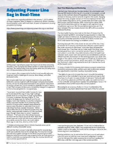
Getting proper sag between power line towers can be time-consuming. at the lowest point.
However, a new surveying tool allows workers to make adjustments in 2. Using a Trimble SX10 scanning total station to acquire needed mea-
real-time. The method saves time and money, while also providing excel- surements and process data, workers were able to determine needed
lent 3-D documentation of the end result. line adjustments in real-time. Courtesy: Geomatikk Survey
For surveyors, the unexpected in the field is not usually welcome.
Surprises lead to challenges to resolve, time delays, and often “The ability to see and compare the chord line with the existing
increased costs. power line on the controller’s big screen enabled us to see in real
time how much each line was outside of tolerance,” Sellevoll said.
But occasionally there are pleasant surprises. Like when Even “So, when they adjusted and lifted the cable, we could monitor it
Sellevoll, a survey engineer with Norwegian company Geomatikk on the controller and see that it needed 50 centimeters more or 10
Survey, set up his integrated total station and scanner instrument centimeters more until it was in the correct position.”
to survey a power line, and it revealed a capability he wasn’t aware
it had. That unexpected discovery completely changed his approach Measuring to an accuracy of plus or minus 3 centimeters, the
to the survey assignment—in a good way. Geomatikk Survey team determined that each of the four power
The project required Geomatikk Survey to mea-
sure and adjust the sag of new, high-voltage
power lines on a mountain in Sogn og Fjordane,
a county in western Norway (Figure 1). The
original strategy was for Sellevoll and his col-
league, Svein Ivar Vestbø, to use the company’s
newly acquired Trimble SX10 scanning total
station to acquire the needed measurements
and process the data to calculate how much
adjusting the lines needed. However, “When
we pointed the SX10 at the first power line, the
sensor automatically locked on to the line itself,
even though there was no prism,” explained
Sellevoll. “That was very interesting because
we didn’t know that it would do that. What that
meant was we could not only more easily and
accurately survey the lines, we could adjust
their sag in real time, directly in the field.”
1. Simply accessing power lines in remote mountain areas can be lines was hanging too low, between 1.5 m and 2 m below the ac-
difficult. Courtesy: Geomatikk Survey ceptable sag limit. With a BKK crew positioned at the transformer
And just like that, a project originally scheduled for several days’ station down in the valley, Sellevoll and his colleague instructed the
work was suddenly reduced to a single day. The new technology tensioning team via telephone.
was not only a game-changer in the field, it is proving to be the
business development tool it was acquired to be: an instrument to Starting with line one, he aimed the SX10 and once it had locked
redefine real-time surveying and to reap the revenue benefits of onto the cable, he told the crew how much adapting it needed.
new business opportunities. Then he followed the cable movements in real time, guiding the
BKK crew until the line’s sag was in the correct position.
22 The Nevada Traverse Vol.50, No.2, 2023