
Page 16 - 2021_48_2
P. 16
Field Note Fundamentals..continued from previous page
started to rain, and the field book got kicked out of the truck and swept down the gutter, never to be seen again. And while he admits
that you can lose a data collector just as easily, there are ways to safeguard and backup electronic data - but not a paper field book.
The case for handwritten notes
Philip Adams agreed that today’s technology is astounding - but sometimes,
you need some good old-fashioned backup checks and balances.
“Just to challenge that new technology, we use heavy photogrammetry
and LIDAR. We’re constantly checking ground observation, ground-truthing,
to compare it. In a conventional survey, we still run an actual close level on
every GPS point that we do. They are just safeguards,” he said.
And while some people may think it’s strange, his team still uses levels on
every job.
“Being heavy construction, GPS just flat out by itself is not adequate for
hardscape construction when you’re on a network. You can do all the checks
you want, but it has a floating variable of about two tenths so that you just
can’t mean out in construction. So we do things robotically, but we have
to run a level of on every single job because you have to know what your
precision is going to be to know which tool to use. And we never lose an
argument when we run a level.”
Philip also said that you can’t lose sight of the history of the profession and
need to cultivate a deep understanding of how things work and why things are done the way they are.
“When the equipment has a failure or question, you need to be able to go back to the old way,” he said. “I think we’ll let go of some of the
use of it, but we can’t let go of the history.”
He gave the example of seeing an airplane flying through the sky. It’s impossible not to look at the plane and know the general history of
how it got into the sky in the first place.
“We’ll still have to go back to the root, the core. So everything that we’re doing, we have to go back to the core root of the development,
whether it’s the survey or the equipment that we use to get the survey,” he said.
The benefits of a hybrid notes system
Just because Philip Adams takes an old-school approach does not mean he
doesn’t value technology. At the end of the day, he sees a clear need for both
legacy systems and new technology to work hand in hand.
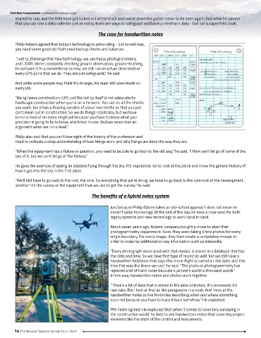
About seven years ago, Adams’ company bought a drone to start their
photogrammetry department. Soon, they were taking drone photos for every
single boundary. For every image, they then create a compilation mosaic in
order to underlay additional survey information such as sidewalks.
“Every photograph associated with that mosaic is stored in a database that has
the date and time. So we have that type of record as well, but we still have a
handwritten field book that says this drone flight occurred on this date, and this
time this was the drone we use,” he said. “The photo or photogrammetry has
replaced a lot of hand notes because a picture’s worth a thousand words.”
In this way, handwritten notes and photos work together.
“There’s a lot of data that is stored in the data collectors. It’s processed; it’s
raw data. But I look at that as like paragraphs in a book. And I look at the
handwritten notes as the footnotes describing when and where something
occurred because you have to trace it back somehow,” He explained.
Phil Fedor agreed. He explained that when it comes to boundary surveying in
the construction world, he likes to see handwritten notes that cover key project
elements like the state of the control and monuments.
14 The Nevada Traverse Vol.48, No.2, 2021