Page 19 - Traverse_49_1
P. 19

Digital Mapper —                                        years ago! Since then, the USGS has published an update to the
                                                                NMAS in 1999, as well as going into more detail by publishing
                                                                the LiDAR Base Specification (2021) and the 3DEP Program
        Technology Column                                       defining LiDAR quality levels for topographic mapping (2021).
                                                                Other groups such as the American Society of Remote Sensing
                                                                (ASPRS) published their accuracy standards in 2014. And the
        Prepared by Michael Detwiler, PLS                       Federal Geographic Data Committee (FGDC) has published
                                                                                              Geospatial Standards that
                                                                                              were developed alongside
                                                                                              the ASPRS. As surveyors
                                                                                              who collect and process
                                                                                              this data, are we all aware
                                                                                              of these standards? Do
                                                                                              we follow these standards
                                                                                              to ensure our clients are
                                                                                              getting what they pay for
                                                                                              by hiring a professionally
                                                                                              licensed individual or firm?
                                                                                              If the state you survey
                                                                                              in is using a standard
                                                                                              that is 25 years old, are
                                                                                              you approaching your
                                                                                              professional organization
                                                                                              or state board to help
                                                                                              update guidelines?

                                                                                              As we add new equipment
                                                                                              to the surveyors toolbelt,
                                                                                              there is the software issue
                                                                                              as well. There are many
                                                                                              software packages that
                                                                                              claim overnight and/or
                                                                                              automated processing.
                                                                                              Magic button tools that
                                                                                              supposedly do all the work
                                                                                              for us. Who can wait days
                                                                                              or weeks when you can
        Professional land surveyors have long benefitted in the   have a deliverable in 24 hours!? Under the responsible charge of
        advancement of technology. Survey instruments have come   a professional land surveyor, are we trusting this data? Do we
        a long way from the Gunter’s chain to EDM, to robotic totals   verify the results through proper QA/QC procedures to ensure
        stations, GPS, scanners, drones and so on. Technology can   our final product is worthy as a professional deliverable?
        advance much quicker than our practical know-how. Learning on
        the fly or trial by fire is often times the only way to keep up! This   Advances is technology confront us in nearly every aspect of our
        can be true of our professional standards and statutes as well.  lives. It is no secret that land surveyor is an ageing demographic.
                                                                Hopefully we can continue to successfully adopt these new
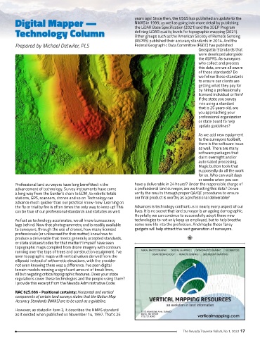
        As fast as technology accelerates, we all know bureaucracy   technologies to not only keep us employed, but to help breathe
        lags behind. Now that photogrammetry and is readily available   some new life into the profession. And maybe these fancy
        to surveyors, through the use of drones, how many licensed   gadgets will help attract the next generation of surveyors.
        professionals (or unlicensed for that matter) know how to
        produce a deliverable that meets generally accepted standards,
        or state statues/codes for that matter? I myself have seen
        topographic maps compiled from drone imagery with contours
        running over the tops of trees and construction equipment. I’ve
        seen topographic maps with vertical values derived from the
        ellipsoid instead of orthometic elevations, with the provider
        not even knowing there was a difference. I’ve seen digital
        terrain models missing a significant amount of break lines,
        all but negating critical topographic features. Does your state
        regulations cover these technologies and the people using them?
        I provide this excerpt from the Nevada Administrative Code:

        NAC 625.666 - Positional certainty: Horizontal and vertical
        components of certain land surveys states that the Nation Map
        Accuracy Standards (NMAS) are to be used as a guideline.

        However, as stated in item 3, it describes the NMAS standard
        as it existed when published on November 14, 1997. That’s 25


                                                                                       The Nevada Traverse Vol.49, No.1, 2022 17
   14   15   16   17   18   19   20   21   22   23   24